
Integrated Remote Sensing for the Arctic (IRSA) is an international collaboration working on developing a system for situational awareness in the Arctic. IRSA will combine data from satellites, high and medium altitude long endurance drones, autonomous sea vessels and more. IRSA’s long-term goal is to offer services for monitoring various types of human activities and environmental factors in the northern regions, to civilian as well as military customers. For testing methods and procedures for IRSA, Andøya Space Defense runs the ArcticX exercises. Andøya Space also uses this aircraft to monitor the areas on and around the island that are closed for public access during launches and missile tests. Andøya Space offers flights for research and technology testing with this plane to customers.
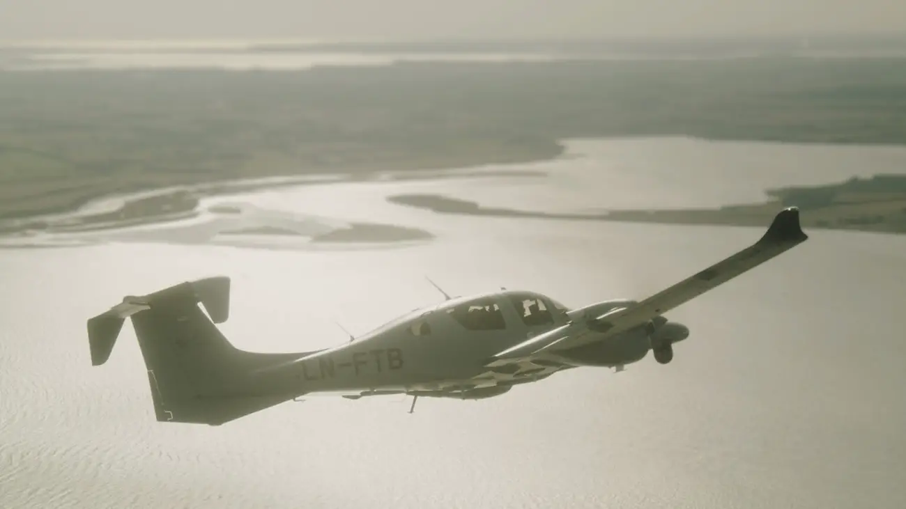
“Andøya Space is a part of IRSA together with the companies C-Core in Canada, My Defence System Integration in Denmark and Boeing in the US. Both public and private actors want a clearer situational image of what is going on in the Arctic, not only concerning human activities such as air and ship traffic, land use and development, but also environmental factors such as pollution, animal migrations, sea ice extent, temperature measurements and more, and for search and rescue. Here we use Andøya Space’s own aircraft, a Diamond DA62 MPP twin-engine propeller aircraft especially designed for research and technology testing. During ArcticX, we use the aircraft to simulate a drone taking pictures from the air”, says Tony Klæboe at Andøya Space Defence.


Satellites can monitor large and remote areas quickly and frequently and are thus well suited for obtaining a good overview fast. During ArcticX Andøya Space Defense has tested, among other things, how quickly the aircraft can get on its wings and find ships that satellite data show have switched off their AIS system. The AIS signals reveals a ship’s identity, position, direction and speed, and all ships above 300 gross tons are required to carry this system. In 2024 Andøya Space Defence will run ArcticX from the 17th to the 20th June. In 2024 the exercise will include subsea vessels to test monitoring of, among other things, underwater pipe lines and cables. IRSA is a fruitful collaboration for Andøya Space and has great potential to lead to services that will be very beneficial to offer customers.
Andøya Space has its own airplane with pilots and mission specialists for performing flights for scientific research, technology demonstration, maritime surveillance, search and rescue, and other types of missions, for both civilian and military customers. The Diamond DA62 MPP plane is 9 meters long and has a wing span of 14.5 meters. Andøya Space purchased the plane in 2021, and until now it has been used mainly for in-house missions. For example, before customers of Andøya Space Defence test their missiles, we use the plane to surveil and monitor the test area from the air, to make certain that there are no land vehicles or maritime vessels around. For such missions, the on board camera is used, in addition to maps of maritime traffic updated in real time. Currently, Andøya Space has two pilots working with the plane, and another will be added to the team shortly. In addition, Andøya Space has four mission specialists that can operate the test instruments during the flights.


