Maxar Technologies, a trusted partner and innovator in Earth Intelligence and Space Infrastructure, announced that Vricon, Inc., a wholly owned subsidiary of Maxar Technologies, Inc., was awarded Phase 2 of the U.S Army’s One World Terrain (OWT) prototype Other Transaction Agreement (OTA) contract worth $39.3 million. OWT is a foundational element of the Synthetic Training Environment-Information System (STE-IS), a modernization initiative led by the STE Cross Functional Team at Army Futures Command (AFC), managed by the Program Executive Office Simulation, Training and Instrumentation (PEO STRI) and contracted through Army Contracting Command-Orlando (ACC-O).
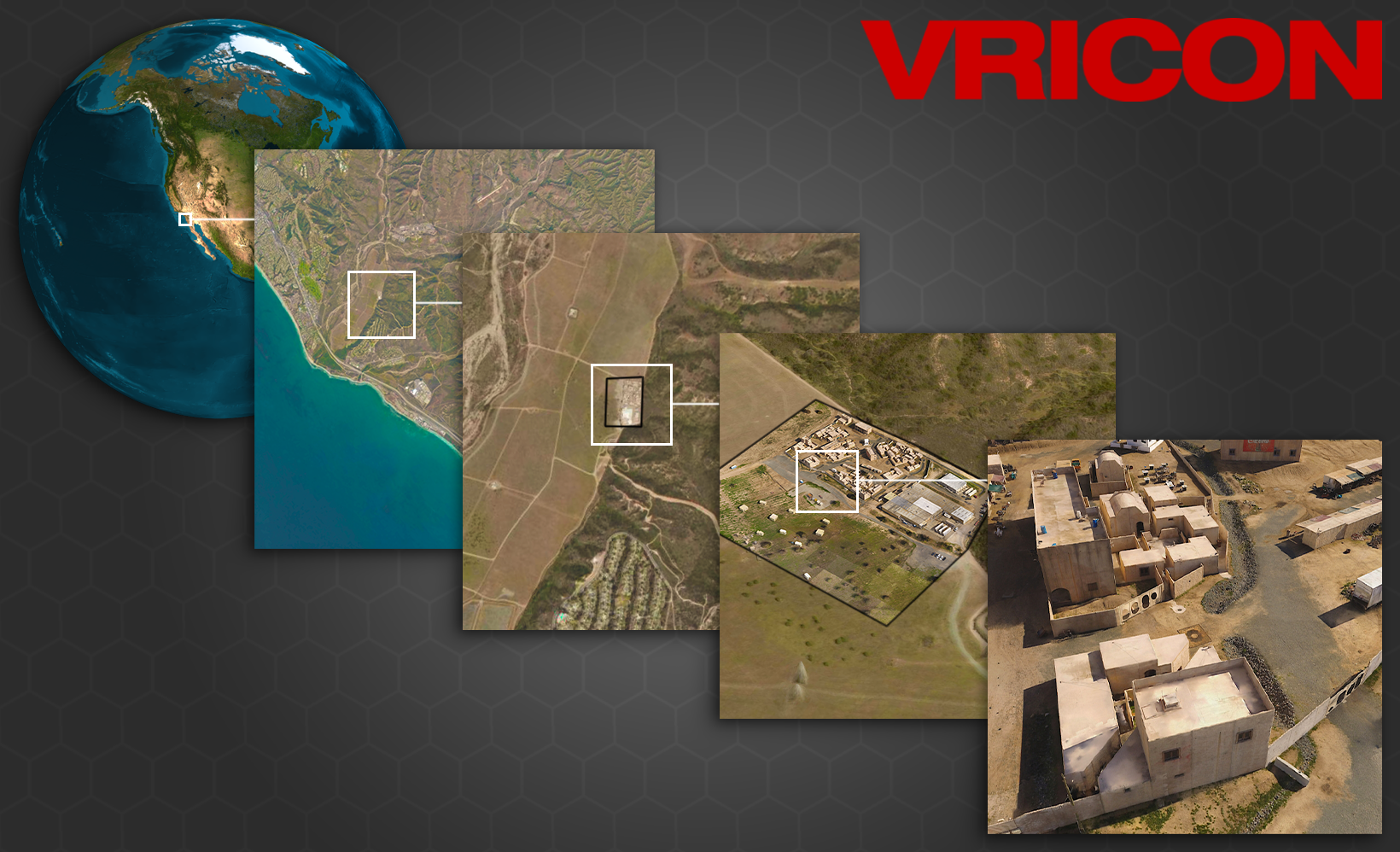
The OWT program delivers 3D global terrain capability and associated information services that support a fully accessible virtual representation of the physical Earth through the Army network. The original $35.8 million Phase 1 OWT contract was awarded in June 2019 to Vricon, which was acquired by Maxar in July 2020. If all three phases and options are exercised, the total value of the OWT prototype project is $94.7 million. The OWT solution starts with the 3D commercial foundation data layer to create a geo-specific, high-resolution representation that accurately reflects the complexities of operational environments.
Maxar’s Vricon completed OWT Phase 1, which focused on Army training and simulation, in late 2020. Throughout 2021, OWT Phase 2 will shift to a focus on 3D geospatial components across the entire U.S. Army, including support of multi-domain operations, mission command systems and other non-training functions. Beyond essential simulation-ready training data, potential applications for OWT include situational awareness, mission planning, navigation, and targeting. Maxar is committed to offering our 3D terrain capabilities globally across industries as demand increases for a multidimensional, highly accurate digital model of the surface of the Earth.
Maxar is a trusted partner and innovator in Earth Intelligence and Space Infrastructure. We deliver disruptive value to government and commercial customers to help them monitor, understand and navigate our changing planet; deliver global broadband communications; and explore and advance the use of space. Our unique approach combines decades of deep mission understanding and a proven commercial and defense foundation to deploy solutions and deliver insights with unrivaled speed, scale and cost effectiveness. Maxar’s 4,300 team members in over 20 global locations are inspired to harness the potential of space to help our customers create a better world.